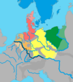
Файл:Germanic dialects ca. AD 1.png
Перейти до навігації
Перейти до пошуку

Розмір при попередньому перегляді: 536 × 600 пікселів. Інші роздільності: 215 × 240 пікселів | 429 × 480 пікселів | 687 × 768 пікселів | 915 × 1024 пікселів | 2067 × 2312 пікселів.
Повна роздільність (2067 × 2312 пікселів, розмір файлу: 703 КБ, MIME-тип: image/png)
Історія файлу
Клацніть на дату/час, щоб переглянути, як тоді виглядав файл.
| Дата/час | Мініатюра | Розмір об'єкта | Користувач | Коментар | |
|---|---|---|---|---|---|
| поточний | 10:28, 30 травня 2024 |  | 2067 × 2312 (703 КБ) | Vlaemink | According to Seebold et al. the Rhine Weser dialects were spoken further east during the 1st century CE. The previous version seems to show a situation closer to the 3rd and 4th century. |
| 15:20, 14 квітня 2022 |  | 2067 × 2312 (776 КБ) | Mårtensås | Reverted to version as of 11:11, 11 January 2022 (UTC) | |
| 15:18, 14 квітня 2022 |  | 2067 × 2312 (767 КБ) | Mårtensås | Minor olor fix | |
| 11:11, 11 січня 2022 |  | 2067 × 2312 (776 КБ) | Vlaemink | This map seems to show a situation closer to 400-600 CE than 1CE, according to Seebold (Seebold, Elmar (2003): Die Herkunft der Franken, Friesen und Sachsen) the Northsea Germanic territories at this point in time did not yet include the Northern Netherlands. | |
| 15:43, 15 жовтня 2018 |  | 2067 × 2312 (791 КБ) | Ax quinque | Reverted to version as of 09:48, 4 May 2018 (UTC) Reverted to more detailed version of the map by AKAKIOS. | |
| 11:30, 22 серпня 2018 |  | 419 × 431 (15 КБ) | Shmurak | Reverted to stable version | |
| 09:48, 4 травня 2018 |  | 2067 × 2312 (791 КБ) | E-960 | Reverted to version as of 20:02, 5 December 2017 (UTC) The other map's boundaries look suspiciously like the boundaries of the Greater Third Reich (see talk page) | |
| 11:12, 30 березня 2018 |  | 419 × 431 (36 КБ) | Til Eulenspiegel | Reverted to version as of 17:44, 5 December 2017 (UTC) used on 3 pages in am., we never wanted a new version, just make a new file instead of overwrite this one we use | |
| 20:02, 5 грудня 2017 |  | 2067 × 2312 (791 КБ) | AKAKIOS | Reverted to version as of 20:06, 3 December 2017 (UTC) Assuming good faith, while waiting on sources for claims. | |
| 19:58, 5 грудня 2017 |  | 2067 × 2312 (816 КБ) | AKAKIOS | Reverted to version as of 07:50, 4 December 2017 (UTC) |
Використання файлу
Такі сторінки використовують цей файл:
Глобальне використання файлу
Цей файл використовують такі інші вікі:
- Використання в af.wikipedia.org
- Використання в am.wikipedia.org
- Використання в an.wikipedia.org
- Використання в ar.wikipedia.org
- Використання в be-tarask.wikipedia.org
- Використання в bg.wikipedia.org
- Використання в cs.wikipedia.org
- Використання в de.wikipedia.org
- Використання в el.wikipedia.org
- Використання в en.wikipedia.org
- Suebi
- Proto-Germanic language
- Talk:Low Franconian
- East Germanic languages
- Ingaevones
- Istvaeones
- North Sea Germanic
- List of Indo-European languages
- Frankish language
- List of early Germanic peoples
- Talk:List of early Germanic peoples
- Elbe Germanic
- Weser–Rhine Germanic
- Dutch language
- User:Kazkaskazkasako/Books/All
- Ingvaeonic nasal spirant law
- North Germanic peoples
- Glossary of sound laws in the Indo-European languages
- Elbe Germanic peoples
- User:AKAKIOS/sandbox
- User:Falcaorib/Ancient Empires (01 AD-150 AD)
- User:Falcaorib/Germany and Prussia
- User:Falcaorib/Iran
- Використання в es.wikipedia.org
- Використання в fa.wikipedia.org
- Використання в fi.wikipedia.org
- Використання в fr.wikipedia.org
- Використання в fy.wikipedia.org
- Використання в gl.wikipedia.org
- Використання в he.wikipedia.org
Переглянути сторінку глобального використання цього файлу.
