Файл:Austria Salzburg relief location map.svg

Повна роздільність (SVG-файл, номінально 1071 × 918 пікселів, розмір файлу: 2,2 МБ)
| Відомості про цей файл містяться на Вікісховищі — централізованому сховищі вільних файлів мультимедіа для використання в проектах Фонду Вікімедіа. |
Опис файлу
| Опис |
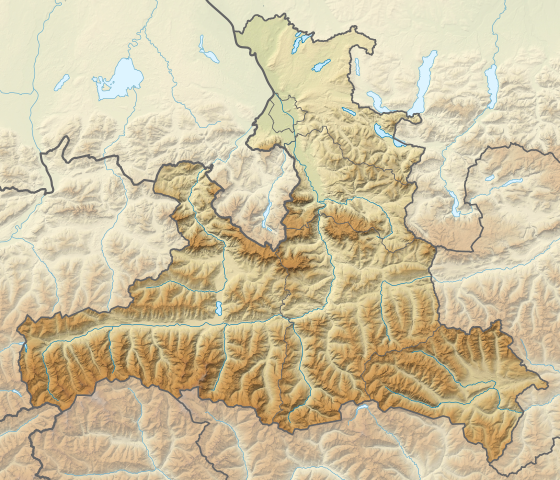
Deutsch: Positionskarte von Salzburg, Österreich.
Quadratische Plattkarte. Geographische Begrenzung der Karte:
English: Location map of Salzburg, Austria.
Equirectangular projection. Geographic limits of the map:
|
||
| Час створення | |||
| Джерело |
Власна робота, using
|
||
| Автор | NordNordWest | ||
| Інші версії |
|
||
| SVG розвиток | Вихідний код цього SVG-файлу правильний. Це векторне зображення було створено з допомогою Adobe Illustrator
|


Ліцензування
Usage of this file with:

explanatory notes: Legally binding is only the full legalcode. For a free usage I recommend to respect the following licence conditions:
1. Provide my name as given above: NordNordWest,
2. a copy of, or the URI for, the applicable license: https://creativecommons.org/licenses/by-sa/3.0/de/legalcode,
3. the title of the work,
4. in the case of an adaptation, a credit identifying the use of the work in the adaptation.
This license and the rights granted hereunder will terminate automatically upon any breach by you of the terms of this license. Any of the above conditions can be waived if you get permission from the copyright holder. If you have questions or wish differing conditions, please contact me through nnwest or my discussion page ![]() t-online.de
t-online.de
- Ви можете вільно:
- ділитися – копіювати, поширювати і передавати твір
- модифікувати – переробляти твір
- При дотриманні таких умов:
- зазначення авторства – Ви повинні вказати авторство, надати посилання на ліцензію і вказати, чи якісь зміни було внесено до оригінального твору. Ви можете зробити це в будь-який розсудливий спосіб, але так, щоб він жодним чином не натякав на те, наче ліцензіар підтримує Вас чи Ваш спосіб використання твору.
- поширення на тих же умовах – Якщо ви змінюєте, перетворюєте або створюєте іншу похідну роботу на основі цього твору, ви можете поширювати отриманий у результаті твір тільки на умовах такої ж або сумісної ліцензії.

Історія файлу
Клацніть на дату/час, щоб переглянути, як тоді виглядав файл.
| Дата/час | Мініатюра | Розмір об'єкта | Користувач | Коментар | |
|---|---|---|---|---|---|
| поточний | 19:58, 15 жовтня 2013 | | 1071 × 918 (2,2 МБ) | NordNordWest | == {{int:filedesc}} == {{Information |Description= {{de|1=Positionskarte von Salzburg, Österreich. Quadratische Plattkarte. Geographische Begrenzung der Karte: * N: 48.0767055° N * S: 46.8998111° N * W: 12.0100138° O * O: 14.0... |
Використання файлу
Така сторінка використовує цей файл:
Глобальне використання файлу
Цей файл використовують такі інші вікі:
- Використання в bg.wikipedia.org
- Використання в de.wikipedia.org
- Salzachöfen
- Kitzsteinhorn
- Festung Hohensalzburg
- Hoher Sonnblick
- Liechtensteinklamm
- Krimmler Wasserfälle
- Großvenediger
- Gaisberg (Salzburg)
- Bischofsmütze
- Hoher Göll
- Großes Wiesbachhorn
- Tauerntunnel (Autobahn)
- Wolfgangsee
- Zittauer Hütte
- Obertrumer See
- Barmsteine
- Entrische Kirche
- Burgruine Gutrat
- Ritzensee
- Riemannhaus
- Oberpinzgau
- Zeller See (Salzburg)
- Fuschlsee
- Trumer Seen
- Mattsee (See)
- Grabensee (Österreich)
- Hintersee (Osterhorngruppe)
- Waldhorn (Schladminger Tauern)
- Steinplatte
- Krimmler Tauernhaus
Переглянути сторінку глобального використання цього файлу.